Bar nearby Bar Juventud
Andorra
Bar nearby Bar Juventud
Bar Juventud
Av de Prat de la Riba, 130, Pallejà Andorra
contacts phone
:
+376
Latitude:
41.417055
, Longitude:
1.99861
read more
nearest Bar
32 m
Bar la Rosa
Calle Joan Molins Parera, 28, Pallejà
Bar
read more
59 m
Bar Chaves
Avinguda Prat de la Riba, 144, Pallejà
Bar
read more
112 m
Bar Las Vegas
Carrer l'Atlàntida, 10, Pallejà
Bar
read more
183 m
Vinalium
Avinguda de L'Onze de Setembre, 16, Pallejà
Bar
read more
191 m
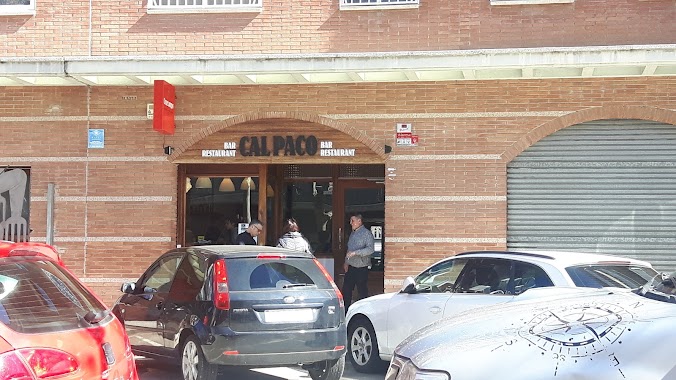
Cal Paco
Avinguda de L'Onze de Setembre, 7, Pallejà
Bar
read more
204 m
Bar La Brasa
08780, Carrer Pla de l'Olivella, 1
Bar
read more
224 m
El Paseo Cerveseria
Avinguda de L'Onze de Setembre, Pallejà
Bar
read more
332 m
La Bodegueta
Carrer Enric Borràs, 4, Pallejà
Bar
read more
357 m
Fabi'Ana's food & drink's
Avinguda Prat de la Riba, 69, Pallejà
Bar
read more
398 m
DGust
Carrer J.Molins Parera, 70, Pallejà
Bar
read more
462 m
Forn Degustació Al Teu Gust
08780, Avinguda Prat de la Riba, 33, Pallejà
Bar
read more
494 m
Punt i apart
Avinguda Prat de la Riba, 24, Pallejà
Bar
read more
514 m
Bar Cal Tobalo
Pallejà
Bar
read more
522 m
Major 9
Plaça Major, 9, Pallejà
Bar
read more
527 m
Bar-Cafeteria Ibias
Ronda de Santa Eulàlia, Pallejà
Bar
read more
545 m
Bar-Cafeteria Punt De Trobada
Spain
Bar
read more
547 m
Bar La Molinada
Carrer Mare de Déu de Loreto, 43, Palleja
Bar
read more
574 m
La Reunió Bar / Rocódrom
Spain
Bar
read more
576 m
LA REUNIÓ
Avinguda Prat de la Riba, 180, Pallejà
Bar
read more
606 m
Palau Tropical
Carrer Miquel Ricart, 14, Pallejà
Bar
read more
756 m
Frankfurt NB
Ronda de Santa Eulàlia, 26, Pallejà
Bar
read more
781 m
Nuevo Maldonado
Carrer Mare de Déu de Loreto, 70, Pallejà
Bar
read more
785 m
Bar Extremadura
Carrer Mare de Déu de Loreto, 71, Pallejà
Bar
read more
942 m
Parèntesi
local 102 Calle San Isidro, Pallejà
Bar
read more
942 m
Parèntesi Y f
local 102 Calle San Isidro, Pallejà
Bar
read more
📑
all categories
Accounting
Administrative area level 1
Administrative area level 2
Airport
Amusement park
Aquarium
Art gallery
Atm
Bakery
Bank
Bar
Beauty salon
Bicycle store
Book store
Bowling alley
Bus station
Cafe
Campground
Car dealer
Car rental
Car repair
Car wash
Casino
Cemetery
Church
City hall
Clothing store
Colloquial area
Convenience store
Country
Courthouse
Dentist
Department store
Doctor
Electrician
Electronics store
Embassy
Establishment
Finance
Fire station
Florist
Food
Funeral home
Furniture store
Gas station
General contractor
Grocery or supermarket
Gym
Hair care
Hardware store
Health
Hindu Temple
Home goods store
Hospital
Insurance agency
Jewelry store
Laundry
Lawyer
Library
Light rail station
Liquor store
Local government office
Locality
Locksmith
Lodging
Meal delivery
Meal takeaway
Mosque
Movie rental
Movie theater
Moving company
Museum
Natural feature
Neighborhood
Night club
Painter
Park
Parking
Pet store
Pharmacy
Physiotherapist
Place of worship
Plumber
Point of interest
Police
Political
Post office
Premise
Real estate agency
Restaurant
Roofing contractor
Route
Rv park, camping
School
Shoe store
Shopping mall
Spa
Stadium
Storage
Store
Subway station
Supermarket
Synagogue
Taxi stand
Train station
Transit station
Travel agency
University
Veterinary care
Zoo
administrative area level 3
administrative area level 4
sublocality level 1
↑